

SPI President & CEO Mary Scott Nabers
There’s a new way for cities to get revenue. And, interestingly enough, it also benefits citizens who need information as well as economic development teams trying to attract new industry to a region.
Think about it…cities have tons of information and data, more than almost any other entity, and people have proven they will pay for data and information. So, cities are finally getting into the act.
The idea of collecting, managing, analyzing and even selling data makes so much sense that many local governments are creating specialized departments called Geographic Information System (GIS) Divisions.
GIS relies heavily on local mapping combined with all types of government-captured information and historical data. When all the information and data is combined and repurposed, very interesting value can be produced.
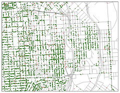
For instance, data from the city of Rusk was used to develop a network for fire hydrants and their location in relationship to the city street network. Government information data is usually considered public domain and is therefore free and available to citizens. However, the more innovative cities are offering to provide customized information and reports for a fee. In fact, the city of Kilgore recently agreed to hire GIS services from the city of Longview.
When all types of data are centralized and categorized, the value benefits public employees as well as citizens. Emergency management officials use GIS to plan for emergencies. Looking at maps, emergency exits, hospitals, flood patterns, public safety offices and traffic patterns is extremely helpful.
One very successful GIS system is located in the city of Santa Rosa, California. The GIS software used there manages inventory and all city assets. The system provides locations of street lights, utility meters, water pipes and sewer infrastructure. It also provides names and contact information for people who live in the area in case notification is required when new projects are proposed for the area.
Houston’s “My City-Houston” GIS system is built around an interactive portal that allows citizens access to all kinds of information via the Internet. It not only provides information that citizens want, but it also allows them to avoid a trip to a city facility.
Fort Worth citizens can access information about city services, park locations, city council districts and garbage pickup schedules. Conroe’s GIS program can be used to access demographic information regarding housing, financial services and education.
Citizens of Scottsdale, Arizona, use the city’s GIS system to generate maps with specific information about fire stations, hospitals, libraries, public schools and park hiking trails. Citizens can monitor construction activity in their neighborhoods and see where building permits and code enforcement notices have been issued. Land information often includes location of flood zones, easement dedications and more.
In Kingsport, Tennessee, GIS is used for site selection analysis. It offers demographic data related to income, population, household age and traffic volume in any area. The system also provides data about topography, utility locations and property boundaries.
As far as selling data and customized reports, that’s a new trend. It may or may not become a revenue source in the future. But, as long as citizens can access the information another way, it seems like a good idea.