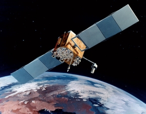
GIS technology is changing the way we live, yet most of us think of it only as the very helpful technology that delivers directions and keeps us from getting lost. GIS technology, however, is so much more.
Public officials at every level of government are using GIS technology for all types of initiatives – planning, addressing emergency situations, micro-targeting public health initiatives and more. After the recent flooding in Baton Rouge, the state, using GIS technology, was able to create a map visualization of the flood’s impact. The map was designed to work in real time and as data came in from numerous sources, it continually changed. Rather than keep the map internal, the city made it available and asked for public input. Information poured in from 911 calls, road closings, Federal Emergency Management Agency (FEMA) reports, search-and-rescue team updates and the public at large. Lives were saved and resources were deployed effectively and efficiently.

Photo By USAF
Public health planning officials are also finding great benefits in GIS technology. The U.S. Department of Health & Human Services (HHS) has used it to combat the spread of the Zika virus. With GIS software, the department is able to gather and map data from all states and present a picture of what is happening in real time. Florida has reported more than 300 cases and the software has mapped the locations of more than 3.6 million women in the state between the ages of 15 to 44 years – the most susceptible individuals. HHS continues to record outreach and prevention efforts while mapping the spread of the virus across the U.S.
Using a combination of data such as historical weather patterns and climate change predictions, the U.S. Environmental Protection Agency developed CREAT, a Climate Resilience Evaluation and Awareness Tool. The tool works specifically for utilities because it collects information about a utility’s assets, location, customers and problems. It then produces custom reports that include future predictions and solutions for consideration.
In Camden, N.J., CREAT made public officials aware of the increasing potential for danger related to rising waters of the Delaware River. The city used CREAT data to prioritize efforts to reduce the amount of stormwater spilling into the gutters. Conservation groups and Rutgers University worked with city officials and green infrastructure was added throughout the city. The projects are now responsible for keeping an estimated 100 million gallons of stormwater out of sewers each year. This saves taxpayer dollars and improves the health of citizens because there is no longer a need to pump or treat the water.
In 1962, Washington Dulles International Airport opened in Virginia. The region around the airport was mostly rural at the time. But by 1986, the county needed access to geospatial data to analyze factors such as floodplains and soil quality because of new land development. GIS tools were used to select the location of a new landfill because factors such as protection of water resources and proximity to population centers had to be considered. The county reports a savings of about $700,000 because of GIS technology.
The same geospatial data has been used to improve decision-making in other sectors, including real estate development. It expedites applications for building permits, farmers use it to locate the best land for specific planting and county-operated buses depend on it.
Because GIS technology is so useful and diverse, the region has implemented GIS instruction in every county high school and an annual GIS Forum for new users is held each year so that students can learn even more about GIS skills.
The next time a smartphone is used for directions, we would all be wise to pause for a moment and ponder the unbelievable potential of GIS technology. It truly does more than help us find our way to new locations.
